Ukraine and the Black Sea - Bibliographical Resources
Bibliographical Resources
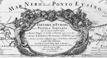
"Ukraine" means "borderland" in eastern Slavic languages. The name was originally used for the territory around the river Dniepr South to Kiev. Home of freebooting Cossacks, this dangerous, very little inhabited land was subject to frequent threats from the Tartars.
The first printed maps were Ptolemaic. They were derived from a manuscript map of Central Europe composed by Nicholas de Cusa, later corrected by Bernard Wapowski, who is considered to be "the father of Polish cartography". Some useful observations were added by occasional travellers like Sigismund von Herberstain. The pinnacle of descriptive geography was Gerard Mercator's map of Europe (1554), on which most of the 16th century maps are based. The first survey was conducted around 1600 by Count Miko?aj Radziwi??. His map of the Duchy of Lithuania was published around 1603, perhaps materials were sent to Hessel Gerritsz, who engraved the map in Amsterdam in 1613 (subsequently printed by Willem Blaeu in his atlases). At the beginning of the 17th century the Polish Commonwealth colonized its south-eastern border, building forts and castles. Many fortifications were constructed under supervision of Guillaume le Vasseur de Beauplan, a French military architect who spent 17 years in Poland (1630-1647). In his spare time he undertook geographic and cartographic researches, on which his maps of the Ukraine and Poland were based. Beauplan’s maps (or more often not very accurate copies by Nicolas Sanson) were used by the major cartographical publishing houses during the 18 century.
This introduction is taken from an online bibliography “Early Maps of the Ukraine and the Black Sea”, compiled by the Ukrainian rare book dealer and collector Volodymyr Dmyterko (Lviv). His wiki is an open project and a very useful research tool, listing manuscript and Ptolemaic maps, more than 200 maps in atlases from 1475 to 1792, an historical sketch of Ukrainian cartography and a bibliography.
Atlas Ukrainae et Ponti Euxini - Early Maps of the Ukraine and the Black Sea
Other Ukrainian bibliographies
Zapasko, Yakym, Isayevych, Yaroslav. Catalogue of books printed in Ukraine (1574-1800). 2 volumes, the second in 2 parts.
The most complete and authoritative catalogue so far. The books are listed in the language in which they were published.
Vol. 1 (1981), books published 1574-1700
Vol. 2, Part 1 (1984), books published 1701-1764
Vol. 2, Part 2 (1984), books published 1765-1800
Maksymenko, F. Old books printed in Cyrillic script from L'viv Libraries. 1975
Old books printed ...
Contrary to Zapasko, this bibliography does not only list books printed in the Ukraine, but also books about the Ukraine which were printed abroad. Both online bibliographies are published on the website of the Ukrainianan Liturgical Center.
(Many thanks for this information to Volodymyr Dmyterko.)