500 year old Waldseemüller map found at the Munich University Library
“Munich librarians have found a rare 16th century world map that first gave America its name as a continent. The version by German cartographer Martin Waldseemüller survived World War II sandwiched between geometry books. The Munich version is smaller than the 500-year-old global map found in a German monastery in 1901 and handed over by German Chancellor Angela Merkel in 2007 to the US Library of Congress. Only four smaller versions were previously known to have survived” (dw).
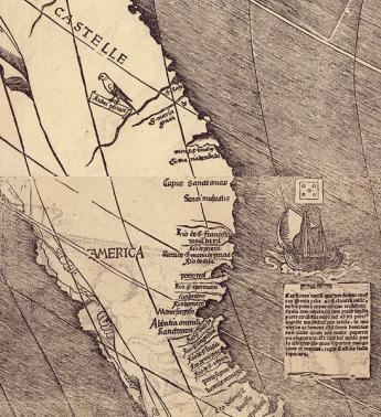
Martin Waldseemüller (1470-1520), was a German cartographer. He and Matthias Ringmann were the first to use the word “America”.
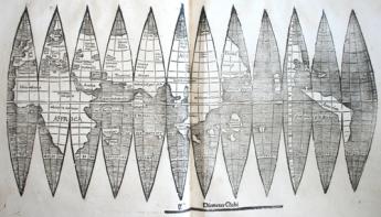
On April 25, 1507, Waldseemüller printed a world map for a globe and a large 12-panel world wall map, the so-called Universalis Cosmographia, on which the name “America” was mentioned for the first time in history. Both maps were accompanied by a book titled Cosmographiae Introductio. This “Introductio” included in its second part a Latin translation of the Four Voyages of Americo Vespucci) and in its first part an explanation by Matthias Ringmann (died 1511) why the name America was proposed for the New World:
ab Americo Inventore ...quasi Americi terram sive Americam
(from Amerigo the discoverer ...as if it were the land of Americus, thus America).
"We've made a sensational find," said Klaus-Rainer Brintzinger, the director of Munich's Ludwig-Maximilian University's Library.
“Several days ago, two women involved in catalogue correction at the library opened a 19th century folio containing two printed geometry works. Sandwiched between them was the smaller A4-sized Waldseemüller map, the university said in a statement. The folio had been bound together by Viennese librarians in 1871, and they apparently did not recognize the map's significance” (dw).
Press articles
>>> Official press release (Munich, July 3, 2012)
>>> Sensationsfund: Forscher entdecken Waldseemüller-Karte (Spiegel, July 3, 2012)
>>> 500-year-old global map found in Munich
>>> 500 year old map of ‘America’ discovered in Munich (Medievalists.net, July 4, 2012)